Introduction
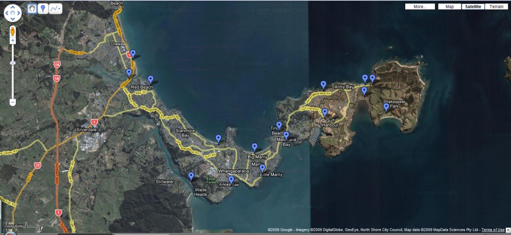
The Whangaparaoa Peninsula stretches east for 11 kilometres into the waters of the Hauraki Gulf to the north of East Coast Bays. The island of Tiritiri Matangi lies three kilometres off its eastern tip.
Because the peninsula is a finger like landmass sticking out into the Hauraki Gulf it’s ideal for taking seascapes.
Special Photographic Features or Notes
With eleven beaches to choose from all having their own personalities you can’t go wrong. From clear white sandy beaches to rocky outcroppings there’s somewhere to shoot for types of seascape photographers.
Night Photography
Although I have not tried night photography here, there’s no reason why you couldn’t shoot at night here, to get some really long exposures.
Special Equipment
This is an east-facing peninsula so sunrise photographers would benefit from Grad ND filters. All the beaches are very calm and safe, so no special equipment is required.
Best Time of The Day
Sunrise.
Because of the orientation of the peninsula it is not really suited to sunsets with only one area (Fisherman’s Cove) facing west.
Tidal Information
At low tide it’s possible to access many rock pools and small inlets all along the peninsula.
Wind Information
Wind isn’t really an issue on this peninsula, if it is windy on side side it will be calm on the other coast 1/2 mile away.
Getting there
Click below for map of the area and places to photograph.


Photographers Heaven — Good to see new guides to NZ mate. This looks like a perfect little spot.
I have a mate up that way.. must fly over for a visit 🙂
David
It’s a beaut of a spot mate. Really nice place to live or visit.