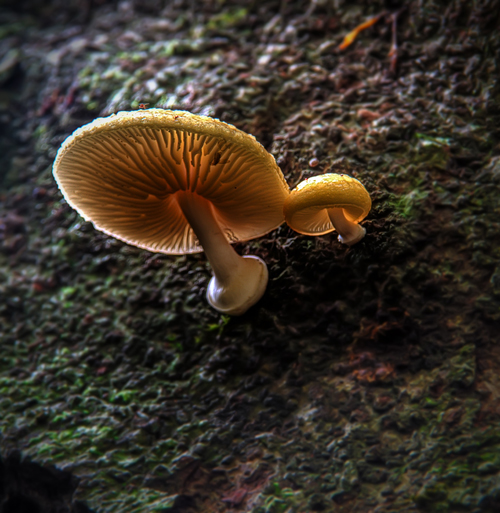
Joalah is an Aboriginal word meaning “Haunt of the Lyrebird”. During the winter months, the loud calls of the male Albert’s Lyrebird can still be heard.
Special Photographic Features or Notes
On entering the rainforest in Tamborine National Park, take the right-hand fork and head down to Curtis Falls.The the track meanders downhill through wet eucalypt forest beneath towering flooded gums.
Take advantage of the viewing platform on the left, allowing rainforest views towards the creek below. A plaque gives information about the illusive “Albert’s Lyrebird”.
After the viewing platform the track gradually descends to Curtis Creek, which is reached after the last set of steps.
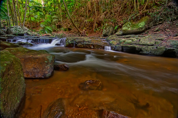
Turn left to reach beautiful Curtis Falls, only a short stroll away. The falls run all year-round, however, they are at their most spectacular after heavy rainfalls. The track ends at a viewing platform overlooking a large rock pool.
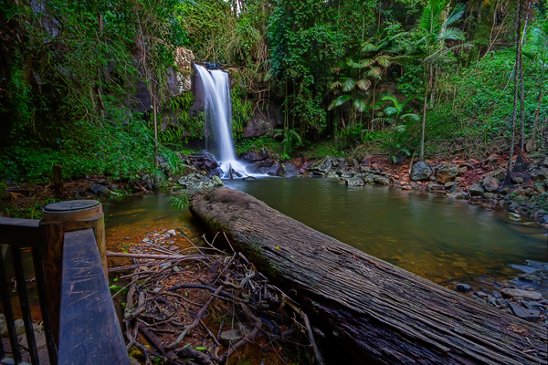
From the large rock pool at the base of the falls see the huge basalt columns, a legacy of the region’s volcanic history. Look for basking turtles on fallen logs and see fish and eels in the rock pool. If you’re lucky you might see the local platypus. At night, look for glow-worms in the surrounding cliffs.
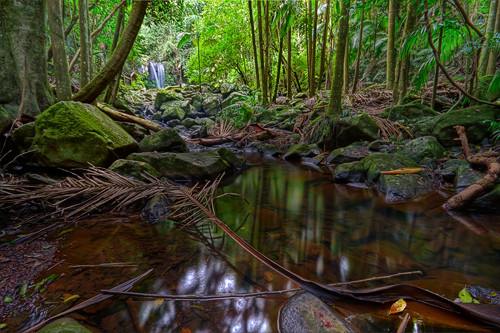
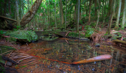
Instead of heading back up to the car parking area again coming back from Curtis Falls, you can follow the piccabeen palm-fringed “Curtis Creek” which starts at the “T” junction, passing several smaller cascades.
Start the circuit walking left crossing Curtis Creek via a concrete bridge, offering beautiful views of the creek in both directions. The rainforest trees are laden with elk horns, stag horns and birds nest ferns. The track passes a large clearing which was created by a fallen giant strangler fig.
There are also remnants of a hut, evident by a weathered concrete slab and the remains of a bush rock retainer wall. The short track to the left is closed; it leads back to Geissmann Drive / Tamborine Mountain Road.
A bit further down the track, another concrete bridge leads again across the creek, this path should be chosen if walking with children or basic footwear. The normal track continues on the left creek bank, winding up and down, with some very narrow sections.
Eventually, an easy “hop-over boulder” crosses the creek at the bottom-most point of the walk.
After the boulder creek crossing, the track turns right back towards Curtis Falls. The track to the left is closed and becomes impassible after a short while, as it is no longer used. Please keep out, the track is no longer safe to use, with rockslides and slippery surfaces.
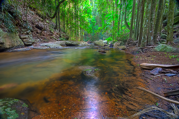
The track passes several very nice rock pools, which are easily accessible, inviting the walker to stop and admire this wonderful National Park. A couple of sections are slightly rougher, please take care when navigating. Eventually, the track crosses the concrete bridge mentioned earlier.
From here on just reverse back to the car parking area.
Special Equipment
Wide angle lens and a tripod are essential. A cable release is greatly recommended because of the low light and specially if you want to use polariser or ND filter.
Also bring a bottle of water it could be a bit sweaty on the way back.
Best Time of Day
This place is best shot on an overcast day as the light through the canopy can be quite strong, or early morning and late afternoon.
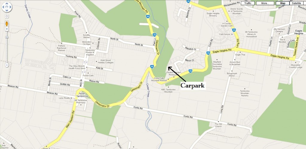
Getting There
Text courtesy of Discover Tamborine Mountain – The Green behind the Gold® discovertamborine.com.au


Fantastic — What a great guide supported by fantastic Rainforest images. Bring it on Chris
Excellent — Have always wanted to go there – your excellent guide and photographs will egg us on, thanks Chris